Frequently Asked Questions
Common questions about this family-friendly, speed-controlled trail designed for riders of all ages and abilities.
A flow trail is a purpose-built mountain bike trail designed for riders of all ages and abilities. The trail features banked turns (berms), rolling terrain (rollers), and optional jumps — all with rollable alternatives so every rider can choose their own comfort level. Features are progressive: gentle at the start, building as you go.
Crucially, flow trails are designed to control speed — berms, rollers, and curves naturally manage momentum, making them slower and safer than descending a steep, straight fire road where gravity just accelerates you. That's the whole point: a controlled, predictable experience instead of the unmanaged fire roads riders use today.
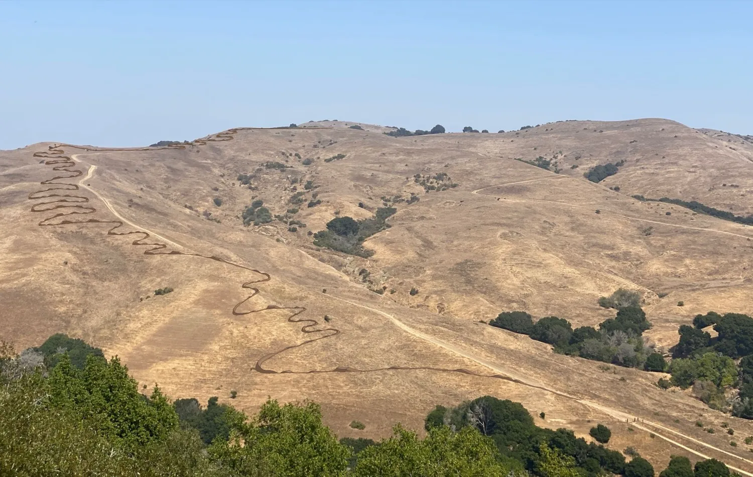
Conceptual rendering showing the trail on the hillside — a narrow ribbon of switchbacks on open grassland. Source: Pointe Strategies / EBRPD
Flow trails create safe, accessible outdoor recreation for the whole community. Here's what they bring:
- Families ride together. Parents and kids of all ages can share the same trail — something that's nearly impossible on steep fire roads or technical singletrack.
- Beginners have a place to start. Not everyone wants to learn to ride on a fire road with hikers, horses, and fast descending bikes. A dedicated flow trail gives new riders a controlled, predictable environment.
- Trail conflicts go down. Separating bikes from shared trails reduces the encounters that lead to friction between hikers, equestrians, and cyclists.
- Community builds around it. At Briones Regional Park, volunteer Dig Days to maintain the new bike trails fill up every time. Flow trails create stewardship, not just recreation.
- Kids get outside. A fun, approachable trail close to neighborhoods gives families a reason to spend time outdoors together.
- Access for underserved communities. The nearest flow trails all require a car trip. A trail at Wildcat puts this experience within reach of Richmond and El Cerrito families who can ride to the park from home.
The trail is rated green/blue (beginner to intermediate) — the easiest difficulty ratings. It's designed so a 5-year-old on a 20" bike and an experienced adult can both enjoy it.
- All features are rollable — wheels never need to leave the ground. Every jump has a ride-around option. (EBRPD project page)
- Speed is controlled by design. Berms, rollers, and curves naturally manage momentum. Unlike fire roads where gravity just accelerates you downhill, the trail's shape keeps speeds in check.
- Average grade of 5-8%. For comparison, a typical wheelchair ramp is about 8%. This is not steep. (source)
- Turnout areas let faster riders pass safely, so beginners never feel pressured.
- Progressive features — gentle at the start, building gradually. Riders choose their own comfort level.
- Bail-out points. The trail crosses the adjacent Mezue fire road as it descends, so riders can exit partway down and ride the road back up. You don't have to commit to the whole trail — families can ride just the easier upper section if that's what works for them.
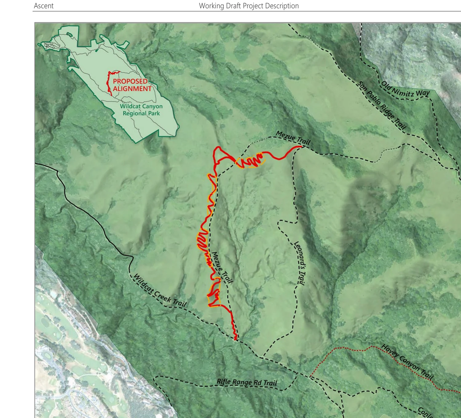
Proposed trail alignment (red) showing the trail crossing Mezue fire road as it descends — each crossing is a natural bail-out point. Source: EBRPD Working Draft Project Description, Figure 2-2
The design philosophy is simple: make the trail fun for everyone, not just experts. The most experienced rider and the newest beginner should both have a good time.
Some photos circulating online show large ramps, drops, and prefabricated features taken from a design catalog. Those are not what's being built. They are examples of features that exist at other trails nationally, included in a design study for reference — not the approved plan for Wildcat.
Here is what EBRPD actually says in their project FAQ:
"All trail features would be rollable, meaning able to be ridden without requiring cyclists' wheels to leave the ground. The trail would be appropriate for beginner and intermediate riders. These features and the ability to navigate them requires riders to moderate speed. The average grade of the flow trail would not exceed 5-8%."
"Rollable" means every feature can be ridden with wheels on the ground — no one has to go airborne. The trail is rated green/blue (beginner to intermediate), not advanced or expert. A 5-year-old on a 20" bike should be able to ride it.
EBRPD has not finalized the design. The final features will be determined through the environmental review process, not from a design catalog.
No. A bulldozer is road-building equipment, and this is not a road. The project is still in environmental review and the design is not finalized. The details below come from EBRPD's current draft project description.
As currently proposed, the 1.44-mile trail (just 36 to 48 inches wide) would be built with small, specialized trail-building equipment: a mini-excavator and a compact trail dozer, along with hand tools, stone work, and carpentry for features like bermed turns.
For perspective, the park's existing fire roads are maintained with full-size road graders. This trail would be built and maintained with far smaller equipment than the roads already crossing the park.
What the draft describes:
- Cut-and-fill is balanced on site, so dirt is shaped in place, not hauled in or out.
- Most rock is sourced on-site to match the natural setting, with some boulders brought in for durable features.
- Construction is designed to minimize disturbance, and ground disturbed outside the trail is replanted and restored.
- Biologists are on site to flag and route around sensitive plants and wildlife. The review includes ten biological protection measures.
- Local bike clubs and volunteers help build and maintain the trail, often by hand on community trail days.
Final construction methods will be set through the public environmental review process. The current draft points to small equipment and hand work, not heavy road construction.
Source: EBRPD Draft Wildcat Flow Trail Project Description, Section 2.4.4 (Construction). A draft document; the project is still under environmental review.
The proposed trail is located in Wildcat Canyon Regional Park, a 2,789-acre park in Contra Costa County managed by the East Bay Regional Park District (EBRPD). The park is connected to Tilden Regional Park and sits in the hills above Richmond and El Cerrito.
The specific alignment was designed by Pointe Strategies and follows a corridor in the western portion of the park, north of Wildcat Creek Trail near Mezue Road — covering approximately 1.4 miles with approximately 500 feet of elevation change.
To put the scale in perspective: Wildcat Canyon (2,789 acres) and neighboring Tilden Regional Park (2,079 acres) together cover nearly 5,000 acres of connected parkland. The project corridor is about 18 acres, roughly 0.4% of that combined parkland (and about 0.6% of Wildcat Canyon alone). The trail itself is far smaller: a 1.4-mile path about 4 feet wide, under one acre of actual ground.
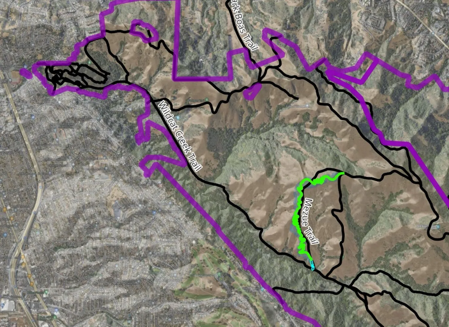
The proposed flow trail (green) within Wildcat Canyon Regional Park, alongside the existing Mezue and Wildcat Creek trails. (See what the corridor looks like today →)
This is the most common objection — "we're not anti-bike, just anti-this-location." But no alternative location is ever named. That's because the requirements are specific:
- Accessible from school: NICA teams from Berkeley, El Cerrito, Albany, and Richmond need a trail they can ride to after school before dark — not a 30-minute drive away
- Already open to bikes: The proposed trail runs directly alongside the Mezue fire road, where bikes already ride today. This isn't introducing cycling to a new area
- Minimal environmental impact: EBRPD staff conducted site assessments and identified this corridor specifically because it avoids or minimizes impacts to sensitive habitats
- Already disturbed: The site is actively grazed cattle land with existing roads, fencing, and ranching infrastructure
- Limited options: Only two parks in west Contra Costa allow mountain biking at all (Wildcat Canyon and Crockett Hills) — both multi-use only. The nearest bike-only trails are at Briones, over 30 minutes away by car.
There's also an equity dimension. The nearest flow trails all require a car trip, and none are within biking distance. Many Richmond and El Cerrito families don't have easy access to those facilities. Building at Wildcat puts a beginner-friendly trail within biking distance of neighborhoods that have historically been underserved by outdoor recreation infrastructure.
In fact, the trail was originally proposed near Leonard's Trail in 2020. EBRPD staff moved it to the Mezue corridor specifically to avoid environmentally sensitive species — demonstrating that the district takes the biology seriously. Staff also evaluated three alternative sites proposed by opponents and found that all three had greater environmental or user impacts than the current location.
The EIR will analyze alternative sites as required by CEQA. But "somewhere else" without naming a specific location that meets these criteria isn't an alternative — it's a way to say no without saying no. (Read EBRPD's full project rationale →)
The Park District's mission is explicitly both. EBRPD's mission is to preserve a rich heritage of natural and cultural resources and to provide "open space, parks, trails, safe and healthful recreation and environmental education." Trails and recreation aren't an exception to the mission — they're written into it, right alongside preservation.
That balance runs through the District's own planning, too. Bicycling has been a recognized use in Natural Units since the 1997 Master Plan, and the 2013 Master Plan opened narrow natural-surface trails to bikes for the first time. Even the 1985 Wildcat Canyon Land Use Plan — the document opponents most often quote — lists park facilities "for hikers, joggers, equestrians, motorists, and bicyclists."
A professionally designed, sustainable flow trail serves the recreation half of the mission while protecting the resources the other half preserves. It's a both/and, not an either/or — exactly the balance the Park District was created to strike. (Read EBRPD's mission statement →)
No. This is a common mix-up between two different agencies. Wildcat Canyon Regional Park is a recreation park owned and run by the East Bay Regional Park District (EBRPD), the public agency that owns and manages the park the trail would sit in. It is not a protected drinking-water watershed.
The protected drinking-water watersheds in our area belong to a different agency, the East Bay Municipal Utility District (EBMUD): the restricted, permit-only lands around its reservoirs such as San Pablo and Briones. Wildcat Canyon is not one of those.
Wildcat Creek did serve as a local drinking-water source about a century ago, but that ended generations ago. The creek's old reservoir (Jewel Lake, upstream in what is now Tilden) was turned over to recreational use back in 1933, once EBMUD brought in Mokelumne River water, and Wildcat Creek has not been a drinking-water supply since.
To be precise, the park does sit within the Wildcat Creek watershed in the ordinary sense that all land drains somewhere, and the creek and its habitat are real and worth protecting. That protection is exactly what the Environmental Impact Report addresses, through water-quality, erosion, and biological review. It is just not a closed drinking-water watershed where recreation is off-limits. In fact, even EBMUD's own protected watershed has opened some of its trails to bikes (the Pinole Valley and Eagle's Nest trails, with a permit).
That's exactly what the Environmental Impact Report (EIR) is designed to determine. The project is going through the full California Environmental Quality Act (CEQA) review — the most rigorous environmental review process in the state.
The EIR will study potential impacts on biological resources, water quality, soil erosion, wildlife, cultural resources, and more. If significant impacts are identified, the project must either mitigate those impacts or the Board can choose not to proceed.
It's also worth understanding the actual site: the proposed trail corridor runs alongside the existing Mezue service road — a fire road that already allows vehicle and bicycle traffic. The area is actively grazed by cattle under a park district lease. This isn't a pristine wilderness being opened up for the first time — the park has a history of human use including a Cold War-era Nike missile installation, the Belgum Sanitarium, and ongoing cattle ranching. It's a working landscape with roads, fencing, and existing bike use. The cattle themselves cause significant ground disturbance, soil compaction, and erosion across the hillside — far more impact than a 4-foot-wide hardened trail. That said, we support a thorough CEQA review to assess and address any impacts. (See photos of the site today)
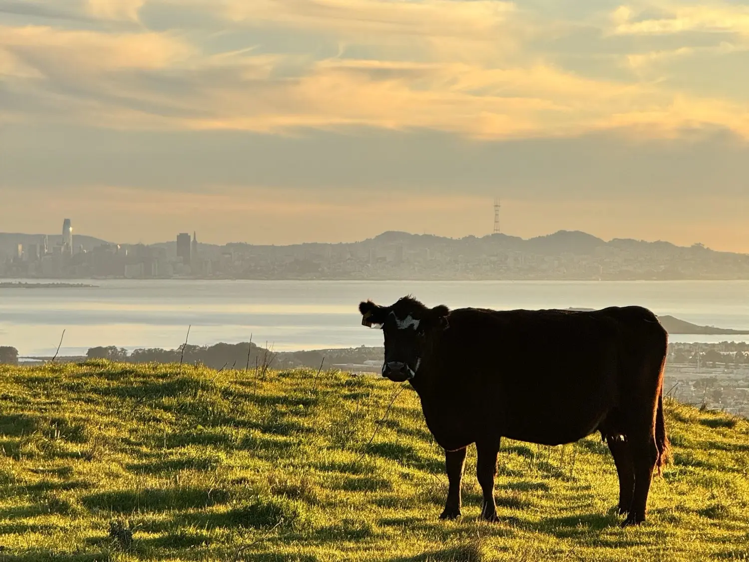
The trail corridor at golden hour: grazed cattle land above Richmond and the Bay, not pristine wilderness.
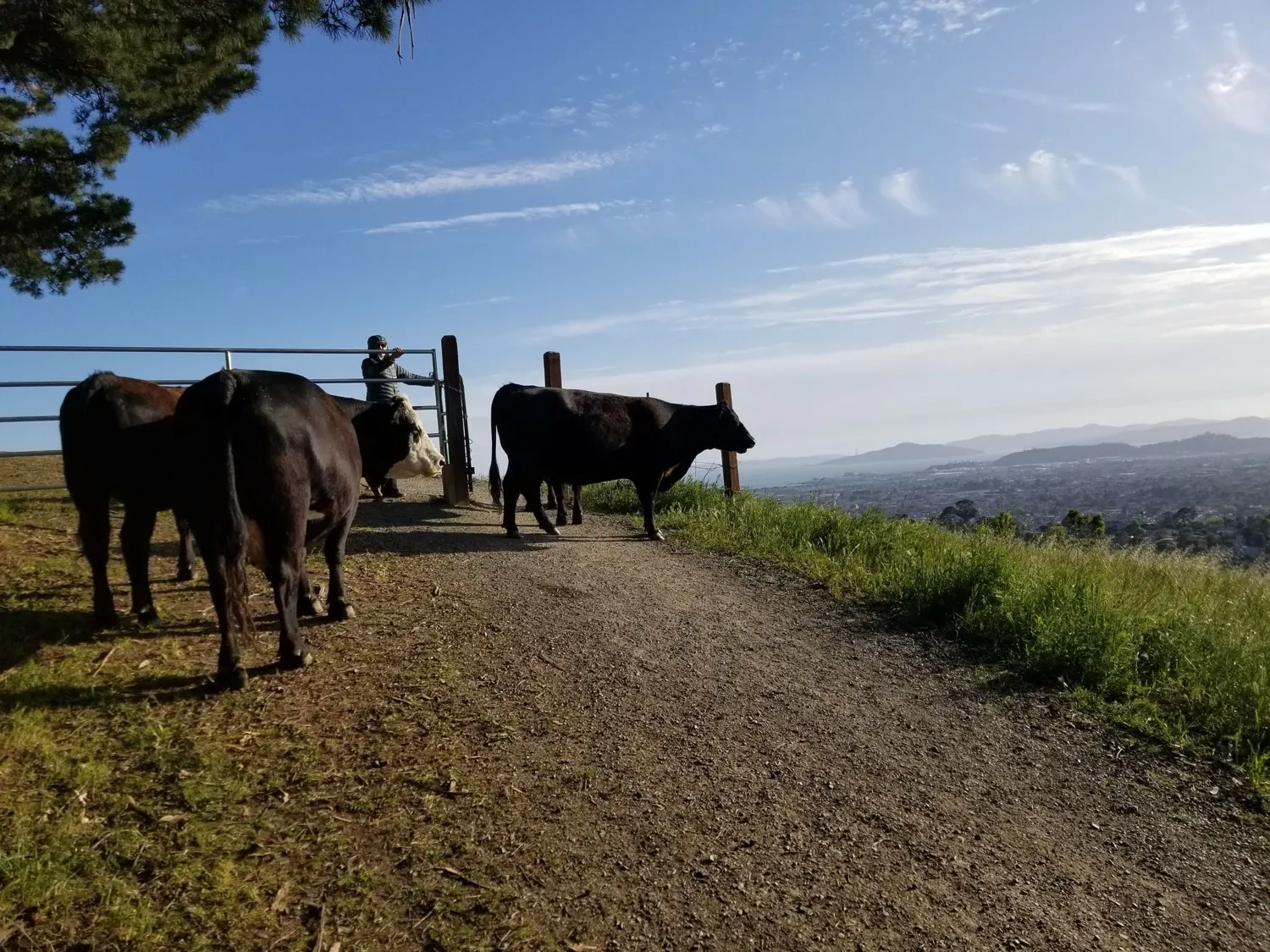
Cattle at Wildcat Canyon near the proposed trail site — an active working landscape, not pristine wilderness.
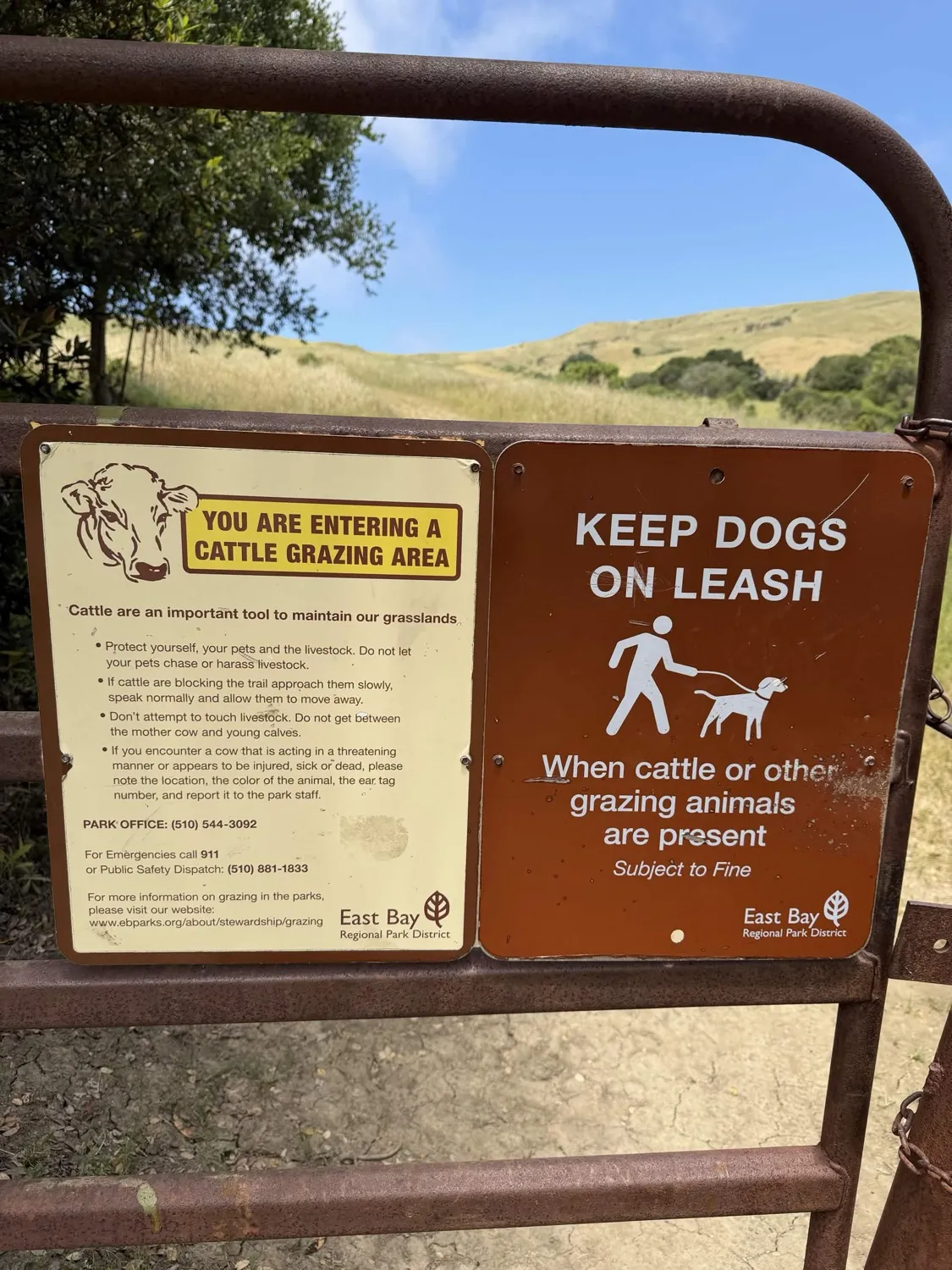
EBRPD's own signage at the trail corridor entrance.
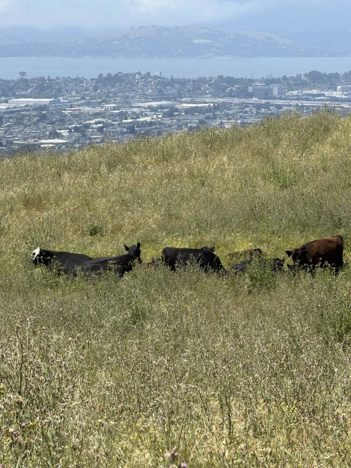
The trail corridor today: cattle grazing with Bay and city views.
EBRPD commissioned a Biological Resources Assessment from Nomad Ecology, a professional ecological consulting firm that conducted field surveys in both 2022 and 2024. Their key findings:
- No special status plant species were detected in the study area — zero, across two years of surveys
- Every impact category was assessed as "less than significant" with standard mitigation measures
- No new barriers to wildlife movement at the landscape scale — fencing will be wildlife-friendly (permeable, smooth, not barbed) with gaps between sections for animal passage
- The trail will not be used at night, when most wildlife is active, meaning no added disturbance during peak movement hours
- 10 specific mitigation measures identified, including pre-construction wildlife surveys, biological monitoring, nesting bird protections, and erosion controls
This is not speculation — it's the conclusion of qualified biologists with degrees in biological sciences who walked the site. (Read the full 72-page Biological Resources Assessment →)
Professionally designed flow trails are built to reduce environmental impact compared to informal, unsanctioned trails. The design manages water drainage, prevents erosion, and concentrates use in a defined corridor rather than allowing it to spread through the landscape.
Local precedent: EBRPD's own Briones Pilot Project (2023–2024) demonstrated this firsthand — when dedicated bike trails were formalized, 5 miles of unsustainable bootleg trails were closed and restored, and 1.28 miles of new pedestrian-only trails were added. The environment got better, not worse. See the full Briones case study →
EBRPD's professional Biological Resources Assessment (conducted by Nomad Ecology, 2022–2024) specifically evaluated wildlife impacts. The conclusion: all wildlife impacts would be less than significant with standard mitigation measures.
Key findings on wildlife:
- Wildlife corridors preserved: The project will not introduce any new barriers to wildlife movement at the landscape scale. The study area is already constrained by dense urban development to the north and west.
- Wildlife-friendly fencing: Only discrete sections of the trail will be fenced, with unfenced gaps between them. Fencing will be permeable, smooth (not barbed), allowing wildlife to pass through freely.
- Mountain lion: The study area is not considered high-quality mountain lion habitat. Any mountain lions in the area would be active at night after the park closes and the trail is not in use.
- Nesting birds: Construction will be timed to avoid breeding season, or pre-construction surveys with protective buffers will be conducted around any active nests.
- 14 special status wildlife species were evaluated. For each one, impacts were assessed as less than significant with the 10 mitigation measures identified in the report.
The trail is being built adjacent to the existing Mezue Trail — an area already subject to human activity including hiking, cycling, and cattle grazing. This is not new disturbance in an undisturbed area. (Read the full Biological Resources Assessment →)
Yes. Both the Wildcat Canyon Land Use Plan (1985) and the EBRPD Master Plan (2013) explicitly support this project. The 1985 Land Use Plan is particularly significant because it recognizes bike riding as an established use in Wildcat Canyon — predating the organized opposition by decades.
EBRPD's own FAQ states it directly:
"The proposed Wildcat Bike Trail is consistent with the Wildcat Canyon Land Use Plan. The Land Use Plan states that bicycling, among other uses, is an appropriate use in Wildcat Canyon. The proposed trail would be developed in an existing opened area of Wildcat Canyon where bicycling is already an established use."
No amendment is needed — the plan already allows it. The 1985 Land Use Plan established bicycling as an appropriate and recognized use in Wildcat Canyon over 40 years ago. This isn't a recent policy decision — it's longstanding park practice with decades of documented history.
The proposed flow trail runs directly alongside the Mezue fire road, where bikes already ride today. This isn't introducing cycling to a new area — it's adding a purpose-built trail right next to an existing bike route.
The main Wildcat Creek Trail — a wide paved road with existing heavy infrastructure. The proposed flow trail would be a 4-foot-wide dirt path. See more photos →
The 2013 Master Plan — the most current plan, superseding all prior versions — defines Natural Units as areas where:
"The primary planning and management objective of a Natural Unit is to preserve and enhance natural habitat. Natural Units constitute the vast majority of the parklands in which lower intensity recreational activities (like hiking, backpack and horseback camping, riding, bicycling, plant and wildlife study, educational pursuits and contemplation) are to be found."
— EBRPD Master Plan 2013, Section a. Natural Units
The 2013 Master Plan goes further, specifically calling for the Park District to:
- "Provide a diverse system of non-motorized trails to accommodate a variety of recreational users including hikers, joggers, people with dogs, bicyclists and equestrians"
- "Continue to add narrow trails designated as both single- and multi-use for hikers, equestrians, dog walkers, and bike riders throughout the system"
This project doesn't violate the plans — it follows them. For comparison, most of Briones, 97% of Pleasanton Ridge, and Crockett Hills are all designated as Natural Units and all contain trails that allow cyclists. This is standard practice across EBRPD. (Source: EBRPD FAQ)
Yes — and the numbers come directly from EBRPD, not from advocates.
According to the EBRPD project page:
- 40,000 riding hours per season are being logged on the same 30 miles of shared multi-use trails in Wildcat Canyon and Tilden
- Bikes are only permitted on approximately 1.5 miles of singletrack in these parks
- The existing trail system is "not adequately accommodating the demand" being placed on it by all users — only 13 miles of narrow trail have been added district-wide in 30 years despite a 46% increase in parkland
- The pressure is "leading to some bikers creating illegal trails" — unsanctioned bootleg trails that damage habitat
- 2,400 petition signatures were delivered to the Board in 2022, which triggered the feasibility study
EBRPD also notes that bike teams from Berkeley, El Cerrito, Albany, and Richmond are growing, and the NorCal NICA chapter — representing high school and middle school mountain bike teams — first approached the Park District about expanding access in 2020.
Consider the geography: over 350,000 people live within regular biking distance of Wildcat Canyon — Richmond, Berkeley, El Cerrito, Albany, San Pablo, and surrounding neighborhoods. More than 1 million people are within e-bike range. This is one of the most population-dense areas adjacent to any EBRPD park.
The demand isn't theoretical. It's documented by the park district itself, and it's already causing problems that a dedicated trail would solve.
Far less than most people assume. Here are the district-wide numbers from EBRPD:
- 208 miles of narrow trails across EBRPD — only 63 miles (30%) allow bikes
- Of those, only 4.52 miles are bike-only trails in the entire district — that's 2%
- In Wildcat Canyon + Tilden specifically, bikes are permitted on just 1.5 miles of singletrack
- Meanwhile, 40,000 riding hours per season are packed onto 30 miles of shared multi-use trails
The proposed 1.4-mile flow trail would be a small addition to a system where cyclists are significantly underserved relative to demand. The 2013 EBRPD Master Plan specifically calls for the district to "continue to add narrow trails designated as both single- and multi-use for hikers, equestrians, dog walkers, and bike riders."
Right now, mountain bikers share the same steep fire roads with hikers and equestrians — and that's where most trail conflicts happen. These fire roads were built for vehicle access, not recreation — they're steep, straight, and wide open, which means gravity naturally accelerates bikes downhill with nothing to control speed. A rider heading toward an uphill hiker or horse on one of these roads creates tension regardless of how respectful riders are. It's a design problem, not a people problem.
The flow trail solves this two ways: it gives riders their own dedicated, directional trail separate from hiking and equestrian routes, and the trail design itself controls speed through berms, rollers, and curves — unlike wide-open fire roads where there's nothing to slow a bike down. Hikers and horse riders get those shared fire roads back with significantly less bike traffic, and the riders who remain are on a trail engineered for safe, predictable speeds.
In fact, EBRPD is proposing to close nearby Leonards Trail to bikes as part of this project — to enhance the hiker experience and protect a special plant species. Mezue Trail will remain open to hikers as well.
This isn't theory — EBRPD proved it works at Briones, where separating uses reduced conflicts and the Board made it permanent. And at Crockett Hills Regional Park, hikers and mountain bikers share 10 miles of singletrack in roughly equal numbers with minimal conflict — because the trails are properly managed, riders use bells on descents, and hikers who prefer bike-free routes have other options. Volunteers there average over 500 hours of trail stewardship per year, and Golden Eagles nest annually in the park. Access and conservation coexist.
Different models work in different settings. Bike-only separation (Briones, Wildcat) and managed multi-use (Crockett Hills) are both proven approaches. The common thread: intentional trail management reduces conflict and protects the environment.
Yes — and this is an important part of the project that often gets overlooked. As part of this proposal, EBRPD is planning to close nearby Leonards Trail to bikes to enhance the hiker experience and protect a special plant species in the area.
So the project isn't just adding a bike trail — it's also removing bike access on another trail. Mezue Trail will remain open to hikers as well. The net result is a better-organized trail system where each user group gets trails designed for them.
This is the same approach EBRPD used successfully at Briones — adding dedicated bike trails while closing and restoring others. It's a rebalancing, not an expansion.
The preliminary trail design was completed by Pointe Strategies, a Colorado-based trail design and land planning firm. They specialize in building sustainable mountain bike trail systems and have experience working with public land agencies across the western U.S.
Their design philosophy prioritizes environmental sustainability, natural terrain integration, and long-term durability. The trail is designed to handle heavy use while minimizing erosion and maintenance needs.
As of early 2026, the project is in the Environmental Impact Report (EIR) phase. Key milestones:
- August 2025: EBRPD Board approved proceeding with the EIR
- January 2026: Notice of Preparation for the EIR was issued
- January 27, 2026: Public scoping meeting held
- Late 2026: Draft EIR targeted for completion
- 2027: Construction possible if the EIR is certified and the Board gives final approval
The Draft EIR public comment period — expected late 2026 — will be the next major opportunity for community participation. See the Project page for the full timeline.
The EIR is the most rigorous environmental review process in California. It will study every concern being raised — that's the whole point. Specific topics include:
- Biological resources — wildlife, vegetation, sensitive and endangered species
- Hydrology and water quality — runoff, drainage patterns, creek impacts
- Soil erosion and geologic stability — slope stability, grading impacts, sediment
- Habitat connectivity — wildlife corridors and movement patterns
- Recreation and public access — impacts on all trail users
- Traffic and transportation — parking, road impacts, greenhouse gases
- Noise and construction impacts
- Visual and aesthetic resources
- Tribal and cultural resources
Every substantive public comment will receive a written response in the Final EIR. If significant impacts are identified, the project must mitigate them or the Board can choose not to proceed. This process exists to get it right — and we support it fully. (Source: EBRPD)
No. Here is EBRPD's official answer, verbatim from their project FAQ:
"The Park District does NOT create projects in response to private donations. Projects are prioritized through a public budget process adopted by the elected Park District Board. Although the Regional Parks Foundation was approached with a generous donation offer in 2021 for this trail, no agreement has been finalized and no funding has been accepted by either RPF or the Park District, because the project is still being vetted by the Park District's Board of Directors."
This project was first proposed by local high school mountain bike teams and their coaches — families from Berkeley, El Cerrito, Albany, and Richmond who ride in the park after school. It exists because of documented public demand — 40,000 riding hours per season on inadequate shared trails, 2,400 petition signatures, and growing NICA youth teams. The donation offer came after the demand was already established, not before.
It's worth noting that some opponents argue the project is being driven by "wealthy special interests," while simultaneously claiming EBRPD can't afford to maintain it. These arguments contradict each other — a local neighbor offering to fund a community amenity is not a special interest, and the offer itself addresses the funding concern.
Does the trail compete with other park priorities? No. The flow trail construction is covered by a private donation — it does not draw from the same budget that funds fire road maintenance, park operations, or other capital priorities. Some opponents have argued that EBRPD should spend money on fire route maintenance instead of the trail, but these are separate funding streams. Opposing the trail will not redirect funding to other projects.
No. This project has been discussed publicly for over five years. Here is every public event on the record:
- December 2020: NICA and BTCEB first propose flow trail to EBRPD
- 2021: EBRPD staff conduct site visits and assessments; move location from Leonard's Trail to Mezue to protect sensitive species
- December 7, 2021: Board open session — petition signatures presented with offer of financial support
- January 2022: Site field visit with EBRPD Board Directors Echols and Rosario
- February 7, 2022: Trail Users Working Group (TUWG) discusses the Wildcat Flow Trail — including opponents who later claimed they weren't aware of the project. Board Executive Committee hears the TUWG's final report and recommends consideration of trail pilot projects, including a dedicated bike flow trail in Wildcat Canyon. (Board Executive Committee minutes and video, Feb 10, 2022)
- 2022: EBRPD budget includes a line item for initial flow trail studies
- April 2022: Park Advisory Committee trails presentation
- December 2, 2022: Board Trails Study Session — staff report "no show-stoppers," three directors speak in support
- April 25, 2023: First public workshop — over 285 community members attended (in-person and Zoom). (EBRPD Public Workshop #1 summary)
- March 19, 2024: EBRPD Board briefing — open public session
- August 5, 2025: Board votes 5-2 to proceed with EIR — 5.5-hour public meeting, the largest Board meeting in three years
- August 20, 2025: Presentation to East Richmond Heights Municipal Advisory Council
- October 21, 2025: Board meeting — authorization to award EIR contract
- November 12, 2025: Presentation to El Sobrante Municipal Advisory Council
- January 27, 2026: Scoping meeting at San Pablo Community Hall
- February 2, 2026: Presentation to Watershed Council
- February 10, 2026: Virtual scoping meeting
That's 17 public events over 5 years — including Trail Users Working Group discussions, Board Executive Committee recommendations, and presentations to local neighborhood advisory councils. All open to anyone. Board meetings are publicly noticed, agendas are published in advance, and anyone can attend or submit written comments. The Board Executive Committee formally recommended consideration of the flow trail in February 2022 — years before anyone claimed the process was "secret."
Local media has covered this project extensively:
- Berkeleyside (January 2026)
- Richmondside (January 2026)
- Richmondside (August 2025 — Board vote coverage)
- Richmond Standard (May 22, 2023 — "Bike-optimized trail proposed")
- Grandview Independent (May 2023 — "Park district considers mountain bike flow trail")
- East Bay Express — "The Wildcat Divide"
- Facebook/EBRPD (April 2023 — "April 25 zoom meeting to discuss a potential bike trail")
EBRPD also publishes project updates on their website, through their Park Explorer newsletter, and through official CEQA notices. A Notice of Preparation was published in January 2026, which is a legal notification that triggers the environmental review process. In fact, the opposition's own attorneys — Greenfire Law, on behalf of SPRAWLDEF — submitted a formal comment letter to the EBRPD Board in April 2023, years before anyone claimed the process was "secret."
Not hearing about a project is not the same as not being notified. The information has been publicly available for years. The full project history is documented on EBRPD's project page.
No. EBRPD addresses this directly in their project FAQ:
"Wildcat Canyon Regional Park does not have the appropriate facilities and infrastructure to hold large race events. Furthermore, NICA races don't typically use flow trails for races. This trail would not be of a length suitable or attractive for such race events."
At 1.4 miles, this trail is far too short for any organized race format. NICA cross-country races use longer, multi-lap courses at parks with staging infrastructure. This is a neighborhood riding amenity, not a race venue.
EBRPD addresses this directly in their project FAQ:
"The relatively short length of the trail, as compared to other mountain bike trails in the Bay Area region, limits its attractiveness as a destination facility. It is anticipated that most riders who would regularly use the new trail are already riding in Tilden and Wildcat Canyon regional parks, many of whom ride their bikes into the parks."
The park has multiple access points — Alvarado staging area, Inspiration Point via Nimitz Way, Hasford Heights, Rifle Range Road, connections from Tilden, and others. A traffic study will be conducted as part of the EIR to evaluate any potential impacts on nearby roads.
EBRPD already has a district-wide e-bike policy that applies to all parks — this trail wouldn't create a new one. The existing rules:
- Class 1 (pedal-assist only, max 15mph) — allowed on trails where bikes are permitted
- Class 2 (throttle) — paved trails only
- Class 3 (throttle, up to 28mph) — not allowed anywhere in EBRPD
There's sometimes confusion between pedal-assist e-mountain bikes (legal, used by many NICA families and older riders) and electric motorcycles/e-motos (not allowed, and opposed by the mountain biking community because they cause trail damage). The flow trail would follow the same e-bike policy as every other EBRPD trail.
Some opponents have raised concerns about Havey Canyon Trail being used as the uphill return route. In practice, the adjacent Mezue fire road — which is right next to the flow trail and already open to bikes — is the more direct and obvious way back up. Riders don't need to go through Havey Canyon.
The EIR will evaluate trail circulation patterns and any impacts on sensitive areas including Havey Canyon. The project's design already includes features to manage how riders enter and exit the trail.
There are several meaningful ways to support the project:
- Sign the petition at wildcatflowtrail.org — over 2,800 people already have
- Submit comments during the Draft EIR public comment period (expected late 2026)
- Contact EBRPD — write to the Board of Directors expressing your support
- Attend public meetings when announced
- Spread the word — share with friends and use #WildcatFlowTrail on social media
Visit our Get Involved page for contact information and more details.
The trail is specifically designed to minimize maintenance burden. The Pointe Strategies design uses sustainable grades (5-8% average), built-in drainage through rollers before and after every berm, and the option for prefabricated features made of wood and metal framing as an alternative to sculpted dirt — all of which reduce long-term erosion and maintenance needs compared to traditional trails.
Purpose-built flow trails actually cost less to maintain than the status quo. Right now, EBRPD is already dealing with the maintenance burden of illegal bootleg trails that riders create when there aren't enough legal options. A single well-designed trail that concentrates use is cheaper to maintain than chasing and restoring unsanctioned trails across the park.
The community also plays a role. At Briones, volunteer "Dig Days" for trail maintenance regularly fill up — riders actively invest in the trails they use. The mountain biking community has a strong culture of trail stewardship, and organizations like BTCEB have decades of experience partnering with EBRPD on maintenance.
Project costs and funding sources — including potential private grants — will be finalized as the project progresses through the CEQA process.
California law already addresses this. Under California Government Code § 831.7, public entities (state, city, county, park district) are generally immune from liability for injuries that occur during "hazardous recreational activities" on public land — including mountain biking, skateboarding, and rock climbing.
This is the same legal framework that applies to every public trail, skate park, and climbing area in the state. EBRPD already manages dozens of parks where mountain biking is permitted under this same protection. The Wildcat Flow Trail would be no different.
It's also important to understand that a flow trail is not an advanced race course. Flow trails are designed for riders of all skill levels — from kids learning to ride to experienced riders. Features like rollers and berms are progressive, with rollable alternatives for anyone who doesn't want to hit a jump. The design manages speed and creates a predictable, controlled riding experience.
This question has been discussed at EBRPD board sessions, and the legal framework is well established.
We respect that some community members have concerns about the project. Common questions include environmental impact, trail user conflicts, and changes to the park's character. These are valid topics that deserve serious study — which is exactly what the EIR process provides.
A few key points:
- Environmental concerns are being addressed through the full CEQA environmental review, the most rigorous process available in California
- User conflict concerns are addressed by the trail's dedicated bike-only, directional design that separates cyclists from all other trail users
- The Sierra Club, which initially expressed opposition, has shifted to supporting continued study of the project through the EIR process
- Mountain biking is already an approved use in the park's Land Use Plan — this project operates within existing policy
- The Briones Pilot Project proved it works — EBRPD's own 20-month pilot at nearby Briones Regional Park formalized 5.75 miles of bike trails (including the district's first bike-only directional trails), closed 5 miles of bootleg trails, and restored natural habitat. The Board voted to make it permanent.
We believe the facts support this project, and we welcome the thorough public review that the CEQA process provides. The goal is to get this right, not to rush it.
The Sierra Club's official national policy, adopted in 1994 and most recently updated in 2023, states:
"The Sierra Club recognizes that bicyclists can be legitimate users of many non-Wilderness backcountry trails and supports responsible off-road bicycling."
— Sierra Club Off-Road Use of Bicycles Policy
Wildcat Canyon Regional Park is not designated Wilderness. It is a regional park that already allows mountain biking on its shared-use trails.
Locally, the Sierra Club initially expressed concerns about the Wildcat Flow Trail, but after several years of engagement shifted to supporting continued study of the project through the full EIR process — which is exactly what is happening now.
The Sierra Club's policy also calls for site-specific analysis, monitoring plans, and cooperation between trail user groups before opening new trails to bicycles. The CEQA environmental review underway for the Wildcat Flow Trail is precisely that kind of thorough, site-specific process.
Yes. 1 in 5 petition supporters identify as hikers, walkers, or runners — not cyclists. Many park users both hike and ride, and a dedicated bike trail benefits hikers too. When bikes have their own trail, there are fewer bikes on shared paths, less conflict, and a better experience for everyone.
The Briones Pilot Project proved this works. After EBRPD created separated trails at Briones Regional Park, hikers, equestrians, and cyclists all benefited. The Board made the program permanent because it reduced conflict and restored habitat.
Separated trails aren't about choosing one group over another — they're about giving everyone a better experience in the park.